1st RAMI Field Campaign
for Aerial Robots
It is our pleasure to announce the first Field Campaign for Aerial Robots of the RAMI (Robotics for Asset Maintenance and Inspection) Competition, that will be held at the Advanced Center for Aerospace Technologies (CATEC) in Seville, Spain, in October 17-21, 2022.
This competition aims to test the skills of the proposed aerial robotic solutions in tasks such as precise autonomous navigation, and automatic defect detection with advanced AI algorithms, while operating in a GNSS-denied environment.
The RAMI competition is organized in the framework of the METRICS project (Metrological Evaluation and Testing of Robots in International Competitions) and aims at addressing Inspection & Maintenance tasks achieved by aerial and underwater robots in risky and/or hostile environments where human intervention is challenging or impossible, where direct link with an operator could not be guaranteed and where autonomous decisions are necessary to reduce operational time of the inspection tasks and ensure repeatability while maintaining an appropriate safety level for the mission. The evaluation process of RAMI competitions mainly involves tasks related to autonomous navigation, data acquisition, detection, classification and autonomous decision-making for inspection purposes. Since aerial and underwater domains are very different, both domains will be evaluated separately in two different tracks.
This first RAMI Field Campaign for Aerial Robots is organised on the basis of the first Cascade Campaign held at IROS 2021, where teams proposed different algorithms for automatic crack detection with AI, and sensor fusion for precise robot localization without GNSS. This competition established a perfect starting point for developing aerial robotic solutions to solve the proposed challenges. More info about this can be found on the Cascade Campaign page, as well as sample real data from CATEC’s indoor testbed via a Docker image.
THE COMPETITION
The competition is inspired by a real use case:
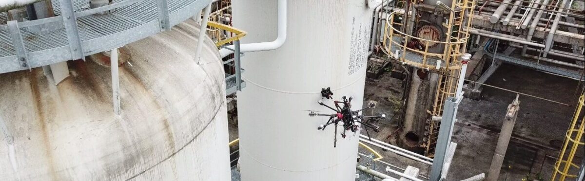
Imagine an old large industrial refinery containing numerous pipelines which are subject to high thermal and mechanical stress, and possible leakage due to defects is a potentially toxic environment. To ensure the production and to avoid compromising the health of the operators, you want to make routine inspections very frequently and check the same critical places.
We propose teams to develop an aerial robotic system capable of autonomously navigate through the refinery to reach the target places, take some pictures of the infrastructure of interest, and automatically detect possible defects on them. Due to the industrial nature of the place, the available space to fly is very limited, with many static obstacles and possibly GNSS and magnetometers will not provide safe navigation capabilities.
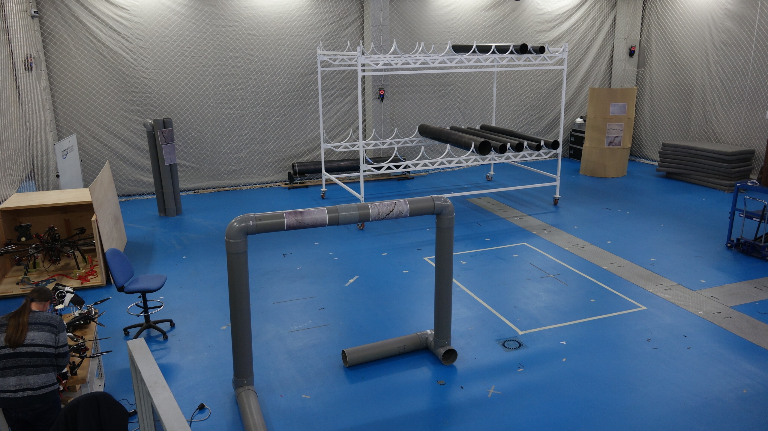
The competition will take place in CATEC's testbed, which is an indoor space for experimental flights of 15x15x5 meters (with an operative area of 10x10x3.5 meters), equipped with a motion capture system and a safety area for pilots and team members.
Will your system be able to carry out the inspection successfully and detect possible defects?
THE BENCHMARKS
The competition will be evaluated according to two functionality benchmarks (FBMs) and two task benchmarks (TBMs).
FBMs:
* FBM-1: precise navigation without GNSS. The aerial robot has to accurately estimate its current state while autonomously navigating through the indoor testbed, making use of any type of onboard sensors except for GNSS devices or magnetometers.
* FBM-2: automatic detection of defects. The team has to automatically detect defects from offline data analysis of the images gathered during the flights of the TBMs.
TBMs:
* TBM-1: punctual inspection in difficult access areas. The aerial robot has to safely reach a specific area autonomously without GNSS or magnetometer, while maintaining a minimum distance to the different obstacles placed over the indoor testbed.
* TBM-2: repetitive inspection. The aerial robot must navigate to the same goal location in order to acquire images of the same location repetitively, allowing for infrastructure time analysis.
Important dates
May 20th, 2022 - Fill out the interest form
October 17-21, 2022 - Join the competition